How To Get There
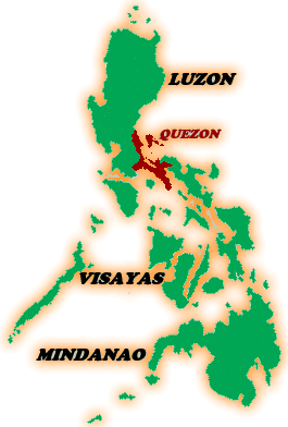
Map
of the Philippines showing the location of Province of Quezon
The
Polillo Islands are situated thirty kilometers off the north-eastern
coast of Quezon Province, Luzon. It is just forty-five minutes
chopper or light plane flight from Metro Manila and Palanan. It
is twenty-five miles of the eastern coast of Luzon , and ninety-five
air miles, (approximately half-hour flight time) from The Ninoy
Aquino International Airport in Metro Manila.
It is twenty-four kilometers west of the municipality of Infanta
and twenty-seven kilometers northern west of the municipality
of Real, Quezon.
You can be reached the Polilio Island by motorboats three hours
via Real-Polillo in the Ungos Port and a little bit shorter via
Infanta-Polillo. Or if you want a pretty long drive from Manila,
about four or five hours thru land, and you have to pass through
Laguna and ride a ferry boat.
It
is also about a three-hour boat ride from the municipality of
Real in Quezon, the Polillo towns are typically rural, with no
permanent and regular public utility buses and jeepneys plying
the routes from one municipality to the other, and the road system
not yet well established.
The
most common mode of transportation is by boat and many residents
have to settle for motorcycles as inland transportation. Only
few of the settlers here own vehicles, although a lot of houses
especially at town centers have already been renovated into big
bungalows.